


3D Laser Scanning
3D Laser Scanning
We take your laser scan projects to the next level
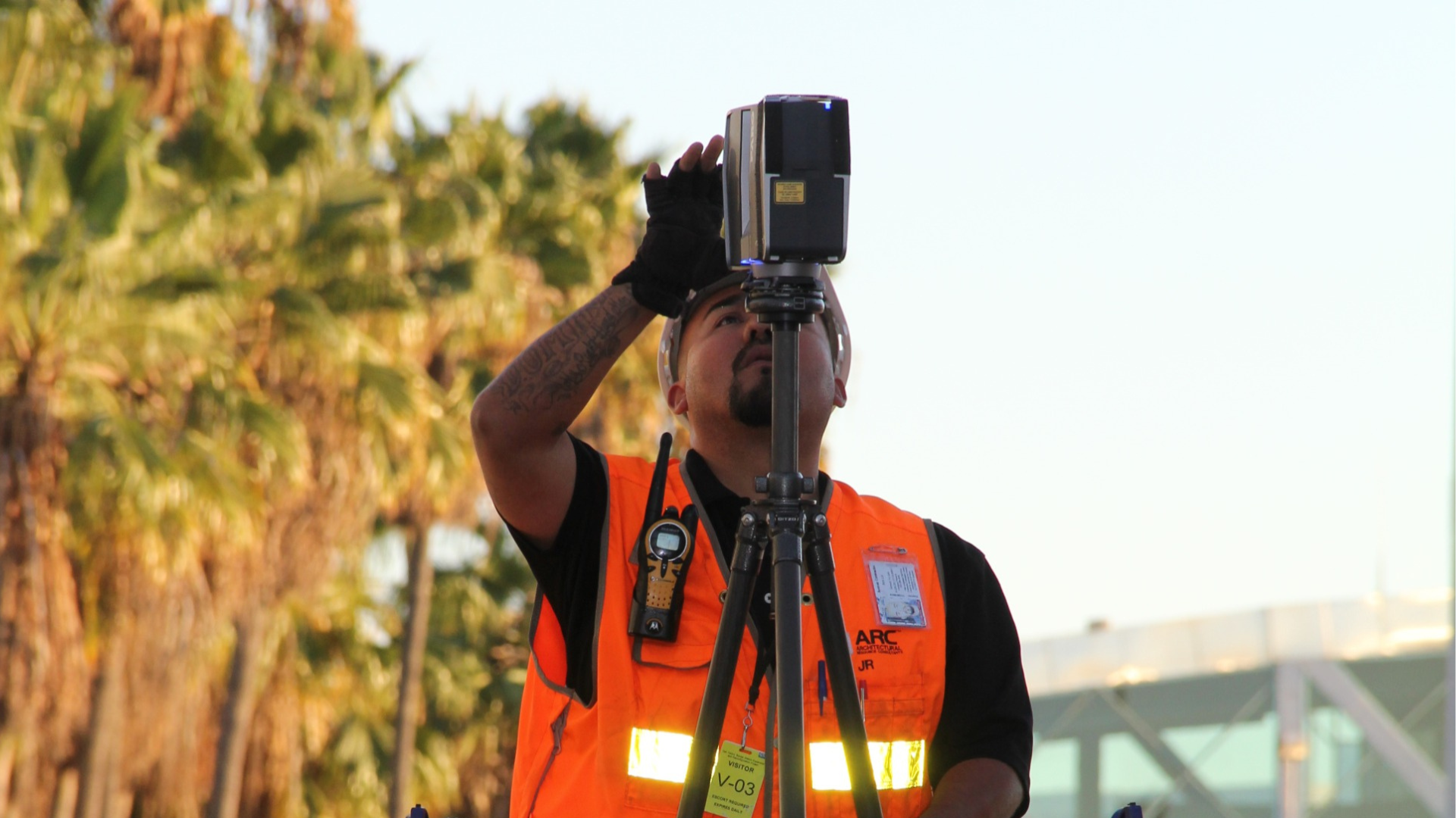
Lasers have become an integral tool in construction. Laser technology has made building easier and safer, from making sure a structure is level to helping produce an architectural plan from a 3D scan.
At ARC, we combine LiDAR technology with advanced laser scanning methods to improve data accuracy and efficiency. Architecture professionals at ARC understand the impact 3D laser scan to BIM can have on the planning and execution of your project, ensuring precise data capture for better design and construction outcomes.

Precision + Accuracy
BIM laser scanning is the most accurate way to represent existing conditions. Through its years of experience, ARC has developed such processes.
Efficiency
Laser scanners can capture up to 2 million measurements per second, which is faster than traditional methods of measure. Hiring an architecture consultant will increase project efficiency.
Freedom to Design
Having confidence is key when proceeding with a design. There is no need be forced into making bad assumptions by outdated floor plans when you can base your designs on existing conditions.
Safety
Worried about on-site surveying hazards? Scanners improve the safety of survey personnel, allowing them to stay clear of operating equipment. A 3D building scan is the optimum way to guarantee site safety.
Quality Assurance
Laser scans generate point clouds which can be utilized for quality control checks, eliminating return trips to the site. Hand measures often require a return trip due to the heightened possibility of errors.
Geo-Location of Data
Laser scan data may be geo-located, giving designers the ability to model on real-world civil coordinates.
Orthogonal Imagery
Scan data can be used to capture and publish structures in an orthogonal fashion for the accurate generation of plans, sections, and elevational views without having to model or draw line work.
Virtual Tours
Scan data may be published as a 360-degree virtual tour, allowing easy access to all users through their web browsers. These tours allow measurements to be taken directly from the laser scan imagery.
Capture Made Simple
Complicated geometries are easily captured with a 3d construction scanner. We can scan and model rockwork, curved and warped surfaces, or even capture and calculate volumes of cut and fill.
Above Ceiling Surveys
Scanners are line-of-sight instruments. If they can see it, they can most likely capture it. This means SMEP/FP systems above ceilings such as ducts, piping, beams, conduits, and fire sprinklers can be modeled.
Time + Cost Savings
Laser scanning gives you the confidence to pre-fabricate materials in the factory and bring them to the site for precise installation, resulting in tremendous time and cost savings.
Risk Reduction
Laser scans can provide designers and contractors accurate information of existing conditions. When field data is not validated, costly change orders and project delays are often the result of the laser survey.
Let's work
together
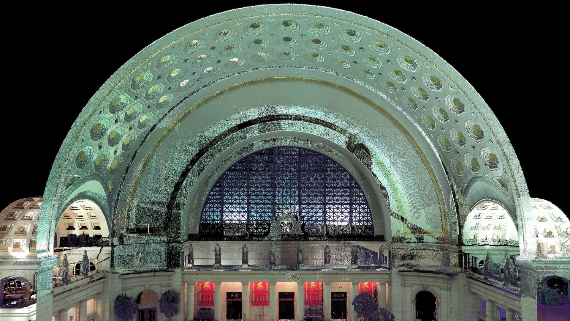
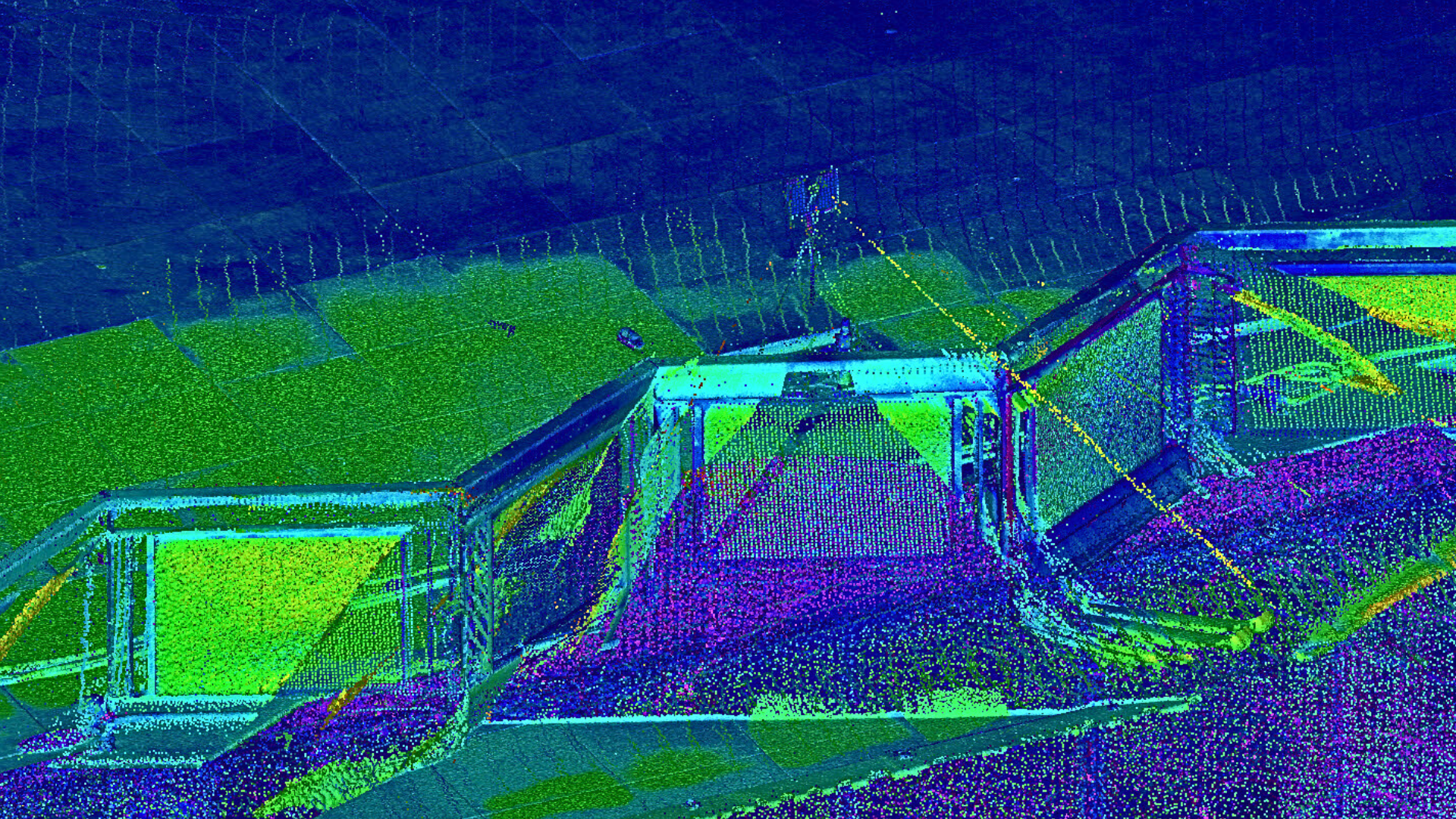
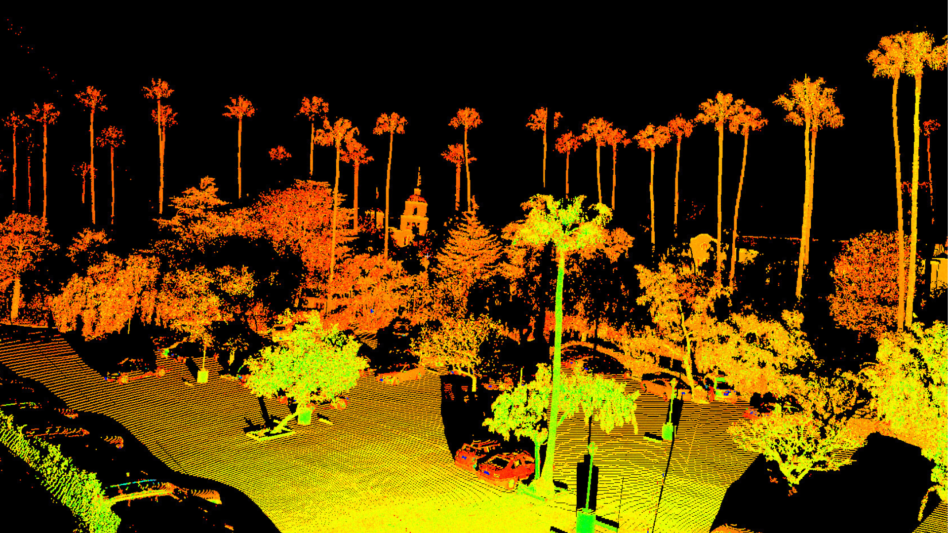
The Art of the Point Cloud
Laser scanners capture everything within their line of sight. As the laser sweeps across a surface, it takes millions of precise measurements. Each measurement results in a single point in space, and together, these points form what is known as a point cloud.
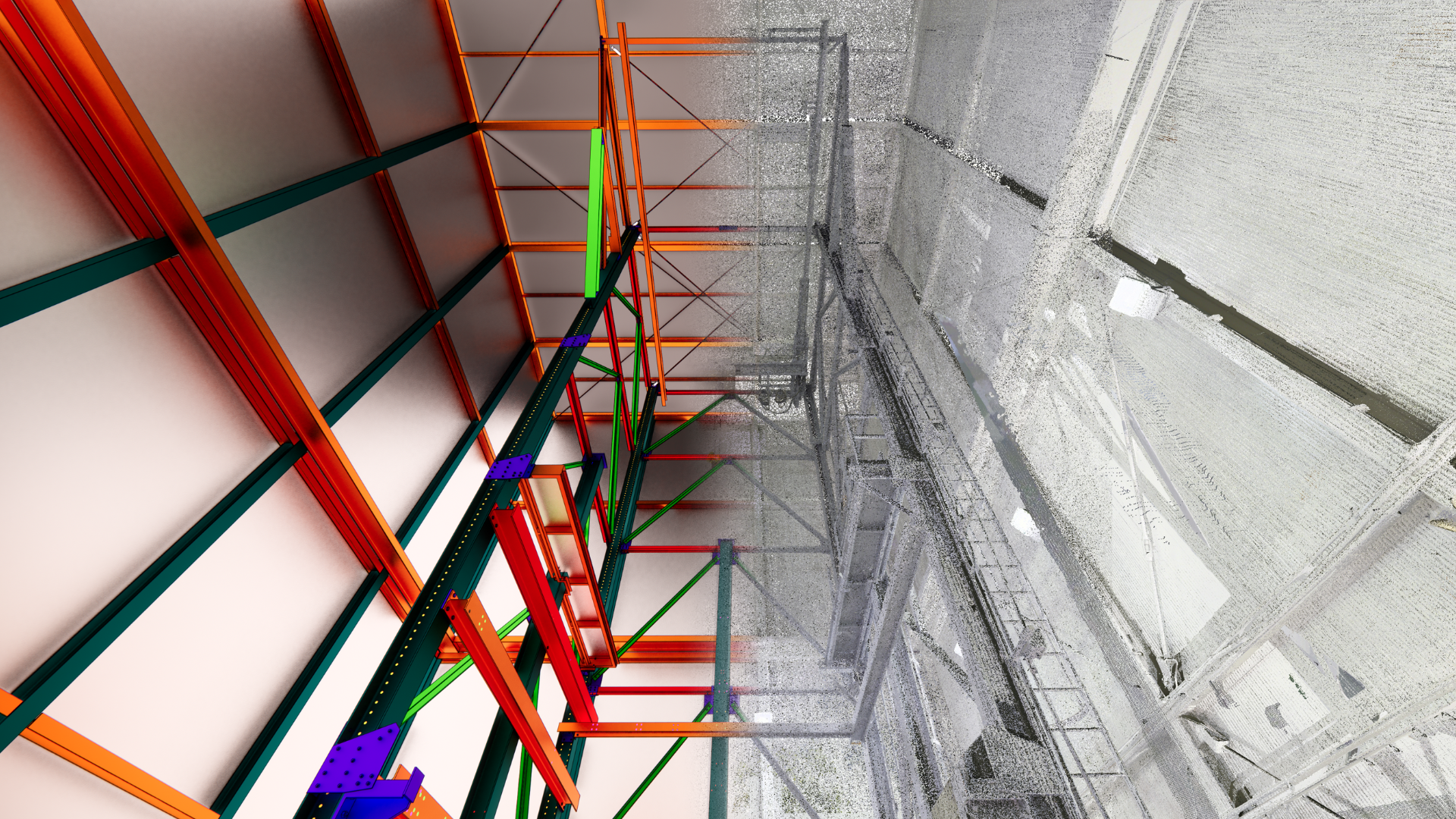
A three-dimensional point cloud reveals all out-of-plumb and out-of-square conditions in the real world. By integrating LiDAR technology, these scans achieve even greater accuracy, ensuring highly detailed representations of structures. The point cloud can then be used to create 2D CAD line work or even a 3D intelligent Building Information Model (BIM) for enhanced design and documentation.
Client Testimonials
Tricia Hamachai
ARC modeled a complex historic building for us. Both the quality of the as-built model and the model delivery meeting were master class. Our team was blown away. ARC was communicative throughout the process and pleasant to work with.
Dan Schriever
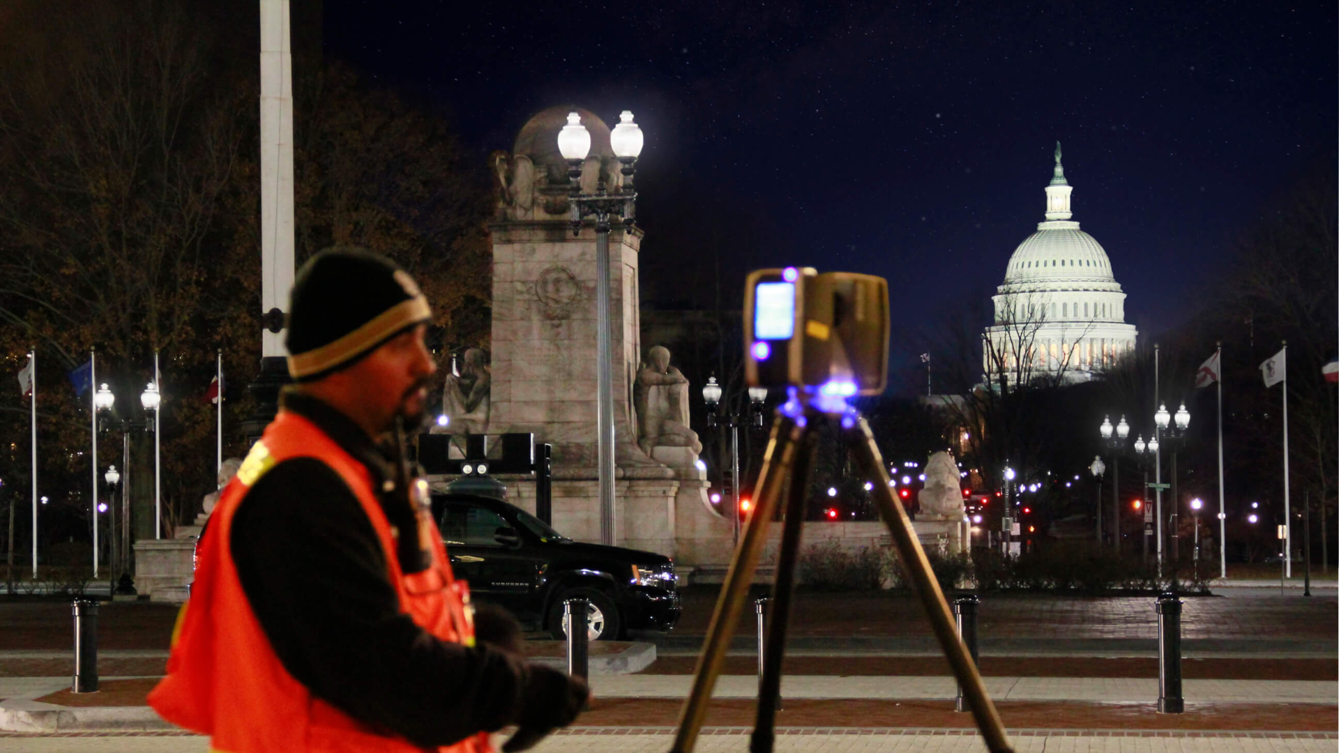
I worked with John and his team on the Union Station project in Washington DC. Both John and his team were a pleasure to work with and very professional. I'm looking for the next project that I can team up with him.
Ryan Trinidad
Having had the pleasure to not only utilize ARC's expertise in the areas of 3D Laser Scanning and production of BIM deliverables, I've also had the good fortune to establish a personal, long-standing relationship with John
More often than not,
We can start faster than you can authorize us.
We pride ourselves in providing innovative solutions,
rapid response, high quality products and service, on time.
However, don't take our word for it.
On target for
success
You, our valued client, are the focus of all we do. We view ourselves as an extension of your team – your strategic partner in reality capture services. We are fully committed to your success, guaranteeing that all phone calls and emails will be promptly returned.
We will provide courteous and professional service, and above all, we will produce the highest quality product every time to support you as you fulfill your project needs and business commitments in reality capture services.
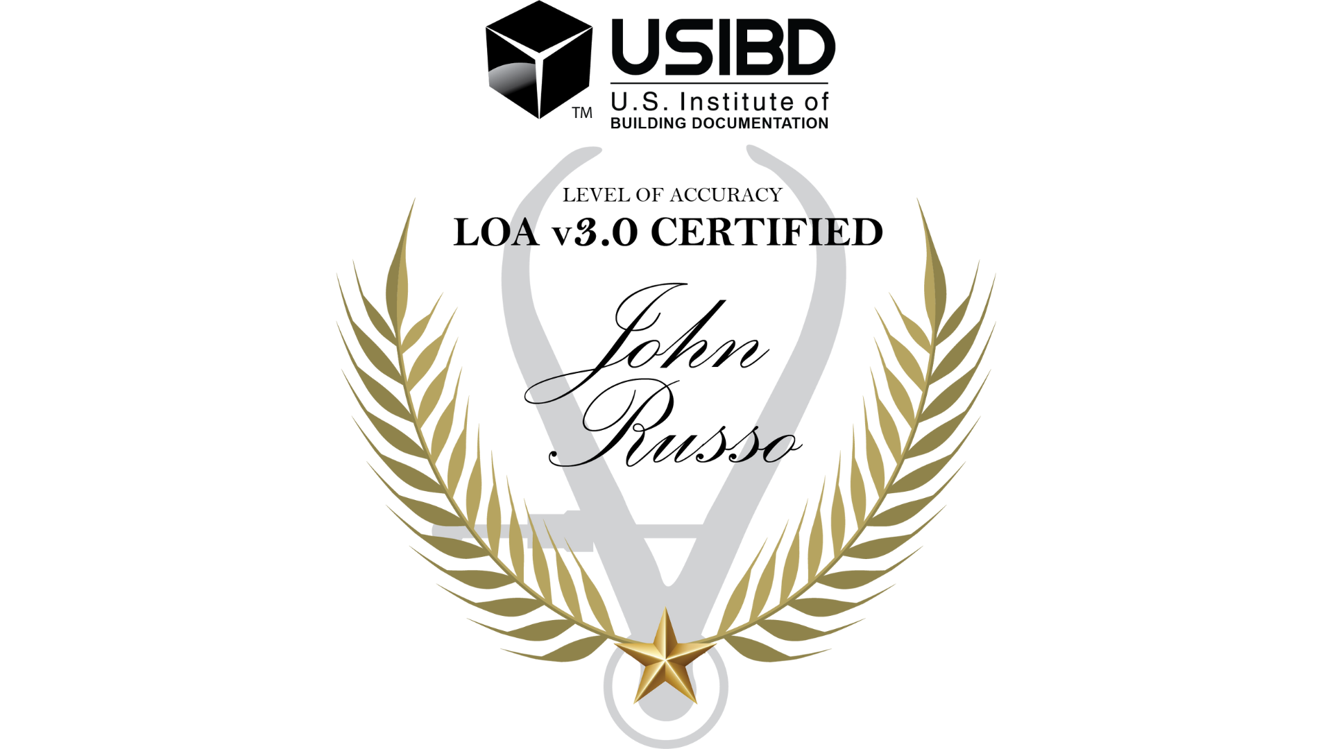
U.S. Institute of Building Documentation/LOA Certified
Staff at ARC is LOA (Level of Accuracy) certified by the U.S. Institute of Building Documentation. The LOA standards were created by the USIBD as a guide for reality capture professionals within the AEC industry.
LOA certified individuals have demonstrated their understanding of the USIBD’s LOA specification and how to apply its principles to ensure accuracy and precision in the measurement process.
To us, every square foot matters. That’s why our professional employees are trained to follow these standards when working on projects—so you can know that your deliverables are always accurate.

Quick Questions
How can I get a 3D building scan of my site?
Using the best laser scanning technology, ARC will scan your site in its as-built condition to create a 3D building scan, giving you the most accurate building model for your project.
How do you go about 3D scanning buildings with safety hazards and limit access?
This technology was made for 3D laser scanning buildings, worksites and other areas that are unsafe for human surveyors. We offer a range of scanners, cameras, and other mapping technology that prioritizes worksite safety.
Who can benefit from using a 3D laser scan in architecture? I found some old blueprint record drawings—isn't this enough?
Old blueprints and record drawings can help with initial planning, but nothing will give you the full picture like 3D scanning for architecture. Property managers, owners, contractors, architecture firms, and designers will be able to budget and plan better with accurate and validated information that only a 3D scanning for architecture as-built can provide.
Why is a LiDAR survey important for construction projects?
A LiDAR survey uses laser pulses to capture precise 3D site data, helping construction teams detect structural issues, measure elevations with millimeter accuracy, and plan efficiently. Its high accuracy improves design alignment, reduces errors, and enhances overall project execution.
Work Schedule
Monday-Thursday,
7:30 am - 5:30 pm
Friday,
7:30 am - 11:30 am
888-362-4272
(Toll-Free)
California
Texas
San Antonio
Houston