


360 Imagery
360 Imagery
We bring buildings to you
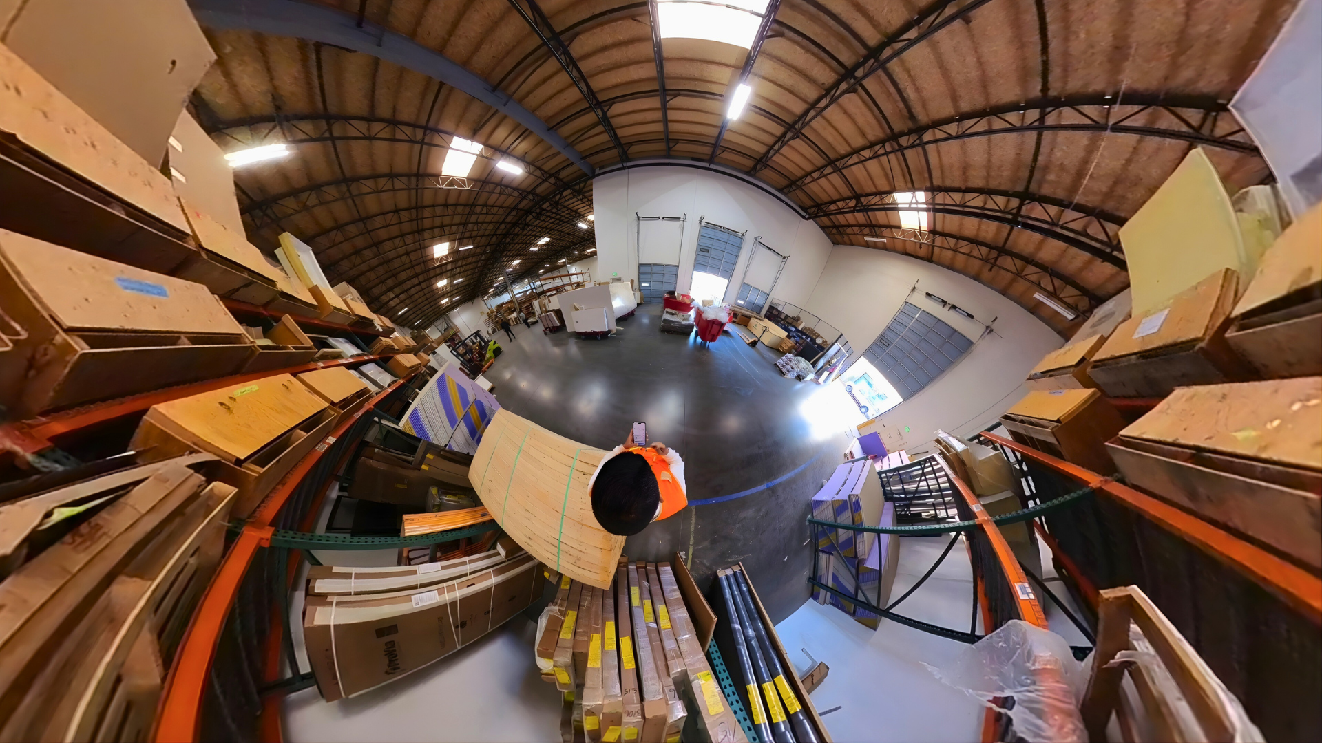
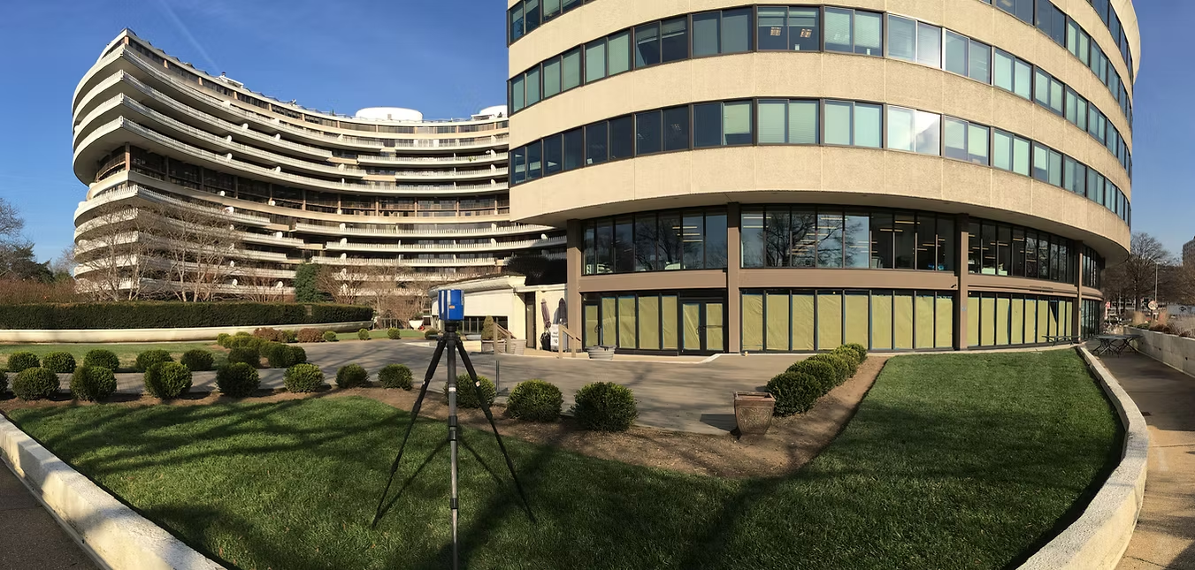
Photo imagery is an essential tool for building documentation, providing clear and accurate visual records of any space.
From simple digital images capturing equipment tags to advanced 360° virtual tours, we utilize cutting-edge Reality Capture technology to create fully immersive building and site tours. These high-quality visuals allow you to explore spaces remotely with unmatched detail.
ARC also provides HDR (High Dynamic Range) imagery for superior image clarity and 360 video walks, delivering an interactive experience similar to Google Street View—so you can navigate your building or site as if you were there. With our reality capture solutions, project documentation and remote access have never been more seamless.
Benefits of 360 Imagery
Virtual Site Walks
Access your project site virtually on-demand whether at your computer, or on your favorite mobile device.
Collaboration
Access to the site can be shared with any project stakeholders. You may also make annotations that will be visible to all users.
Save Time
Accessing the site virtually will cut back on, or eliminate travel time to and from the site. Pull it up on your mobile device and spend your time on more productive work.
Safety
Given today's COVID-19 concerns and the mandates for non-essential workers to stay at home, we can bring the job site to you virtually. Stay home and stay safe.
See Everything
View the whole scene with 360 imagery. Gone are the days when what you need to see is just outside the frame of your still image.
Time Lapse
View and compare the same scene at different points in time. This is a great way to see what was inside a wall, or above a ceiling before it was closed up.
Let's work
together
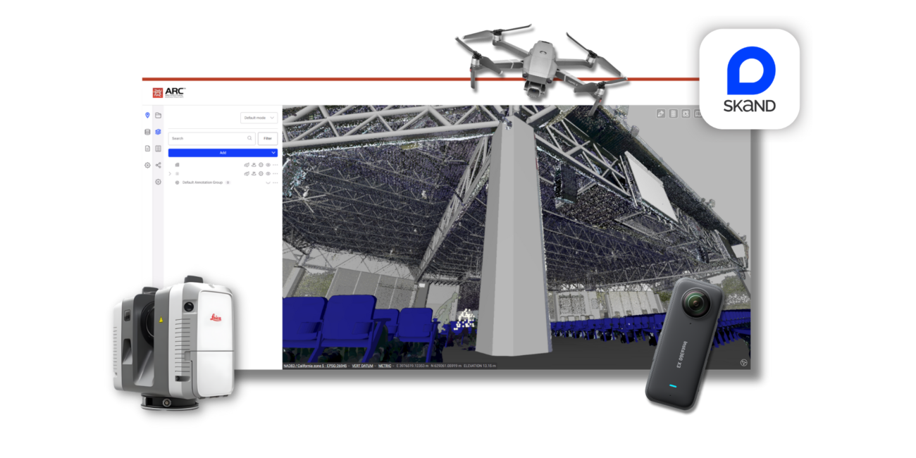
Skand
Skand is one of ARC’s 360° imagery solutions, offering an intuitive platform to visualize and share site data. It combines 360° photos, point clouds, and panoramic walkthroughs in a single viewer, allowing users to explore spaces with full spatial context. Skand enhances collaboration, streamlines communication, and ensures up-to-date site information is always accessible—anytime, anywhere.
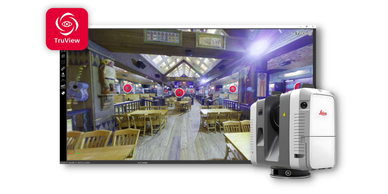
Leica TruView
Matterport is another of ARC’s 360° imagery solutions, providing an immersive, interactive walkthrough of your project. Using high-resolution 3D scans and panoramic imagery, Matterport captures every detail of a space for easy viewing, measuring, and collaboration. It delivers a realistic, digital replica of your site—accessible from anywhere—to support design coordination, client presentations, and project documentation.
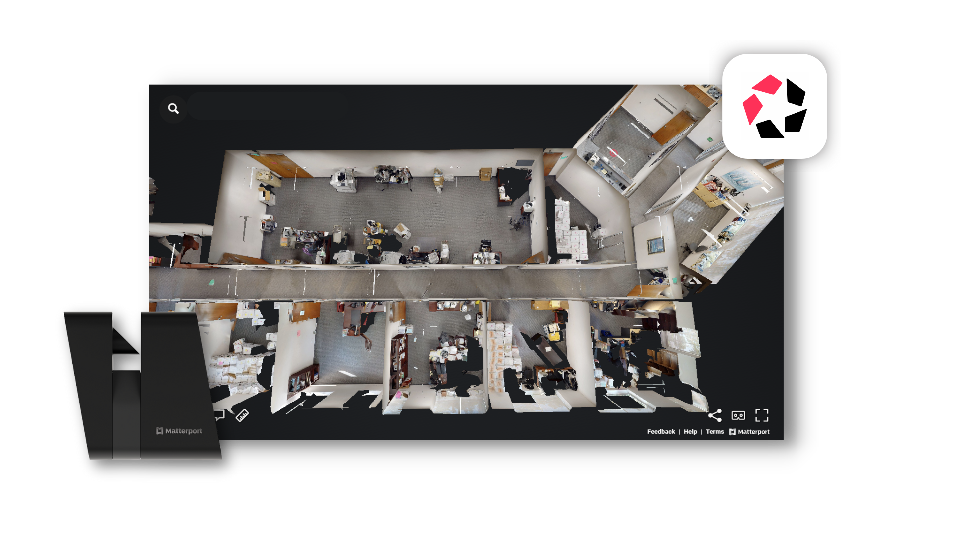
Matterport
Matterport is another of ARC’s 360° imagery solutions, providing an immersive, interactive walkthrough of your project. Using high-resolution 3D scans and panoramic imagery, Matterport captures every detail of a space for easy viewing, measuring, and collaboration. It delivers a realistic, digital replica of your site—accessible from anywhere—to support design coordination, client presentations, and project documentation.
More often than not,
We can start faster than you can authorize us.
We pride ourselves in providing innovative solutions,
rapid response, high quality products and service, on time.
However, don't take our word for it.
Work Schedule
Monday-Thursday,
7:30 am - 5:30 pm
Friday,
7:30 am - 11:30 am
888-362-4272
(Toll-Free)
California
Texas
San Antonio
Houston
Work Schedule
Monday-Thursday,
7:30 am - 5:30 pm
Friday,
7:30 am - 11:30 am
Texas
San Antonio
Houston
Get in Touch
Work Schedule
Monday-Thursday,
7:30 am - 5:30 pm
Friday,
7:30 am - 11:30 am
Get in Touch
Texas
San Antonio
Houston